
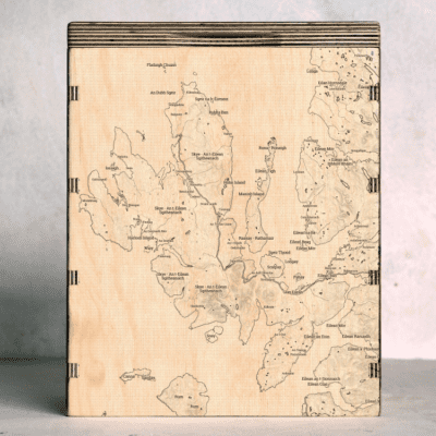
The Map Box provides a proper place to store your messy OS Maps. It is designed to take around 20 of the normal paper Ordnance Survey maps, and so will also suit other maps in a similar format. We engrave a map onto the front of the box, which is where it gets interesting for you! You can choose from our Map Box Collection of existing map designs. Or you can Design your own Map Box which allows you to move a map around and choose your own place to feature.
On the lid of the Map Box is a simple compass design. You also have the option to add some text of your own, which is added just underneath the compass.
| Weight | 2 kilograms |
| Outside Dimensions | Height 27cm x Width 22cm x Depth 17cm |
| Inside Dimensions | Height 24cm x Width 20cm x Depth 15cm |
| Number of standard paper OS Maps | Approx. 20 |
| Material | Top grade birch plywood |
| Finish | Osmo Polyx Oil |
| Delivery Time | Posted usually 3-5 days after ordering, by Royal Mail Tracked 24 in the UK |


Reviews
There are no reviews yet.